
Note: I originally wrote this article for the General Aviation Council of Hawaii Fall 2012 newsletter. Had to make a couple tweaks to the dual-polarization section, since upgrades at all Hawaii radars were completed in 2013. –JB
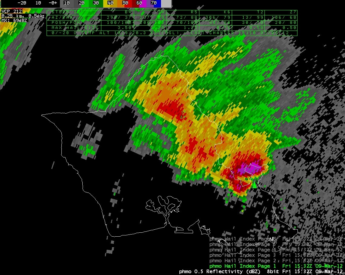
Radar image of a supercell thunderstorm from March 9th, 2012. This storm brought large hail to Kailua and Kaneohe, including a record-setting hailstone that measured 4.25 inches long, and generated a tornado that damaged homes in Lanikai.
Weather radars are one of the most effective tools for detecting rainfall. This article includes information about weather radar in general, and about the specific radar sites we have in Hawaii.
Weather Radar Basics
The radar transmits an electromagnetic pulse, which reflects off objects in the atmosphere. (The objects could be anything, not just precipitation; one common problem around Hawaii is with sea spray being detected during windy days.) A small fraction of the energy is returned to the radar. The radar measures how much energy is reflected back, and how long it took to return. The energy is converted into reflectivity, and the time is converted into distance from the radar. Larger or more numerous objects return more energy, and result in a higher reflectivity.
The radar pulses have an average power of 450,000 Watts. However, each radar pulse lasts less than 1/600,000 of a second, which is followed by a listening period that lasts almost 1/1,000 of a second. For each hour of operation, the radar is only actually transmitting for seven seconds.
The radar also determines the velocity of the objects it detects, which can be used to infer wind speed in the atmosphere. The radar measures the change in phase of the beam between two pulses, and uses the difference to estimate the object’s speed. However, because the phase only changes when an object moves along the radar beam, the radar can only measure movement toward or away from the radar.
Volume Scans
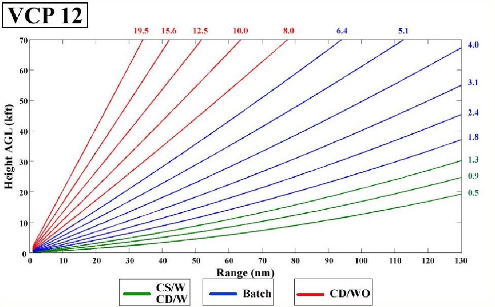
Example storm mode VCP. In VCP12, the radar will scan 14 elevation angles in 4.2 minutes.
Weather radars don’t just scan along one level. Because it’s important to see the elevated structure in features like thunderstorms, the radars regularly cycle through different elevations. These elevations range from 0.5° above the horizon to as high as 19.5° above the horizon. The farther away from the radar the beam travels, the higher above the ground it is located.
There are predefined scan sets that control how the radar cycles through the different elevation angles. These are known as volume coverage patterns (VCP). The three main categories of VCPs are:
- “Clear air mode” is used primarily when conditions are dry. In this mode the radar cycles through five elevations every 10 minutes. This VCP is hardly ever used in Hawaii.
- “Precipitation mode” is used when rain is occurring. In this mode the radar cycles through nine elevations every six minutes. This is the most common VCP that is used in Hawaii.
- “Storm mode” is used during severe weather. In this mode the radar cycles through 14 elevations every 4.2 minutes.
Locations in Hawaii
There are four weather radars in Hawaii. The location of the radars is important, and not just to make sure that they cover the entire state. The energy transmitted by a radar travels in a straight line, and the terrain of the islands can block the radar beam.
 South Kauai (PHKI): Located near Port Allen at an elevation of 290 feet.
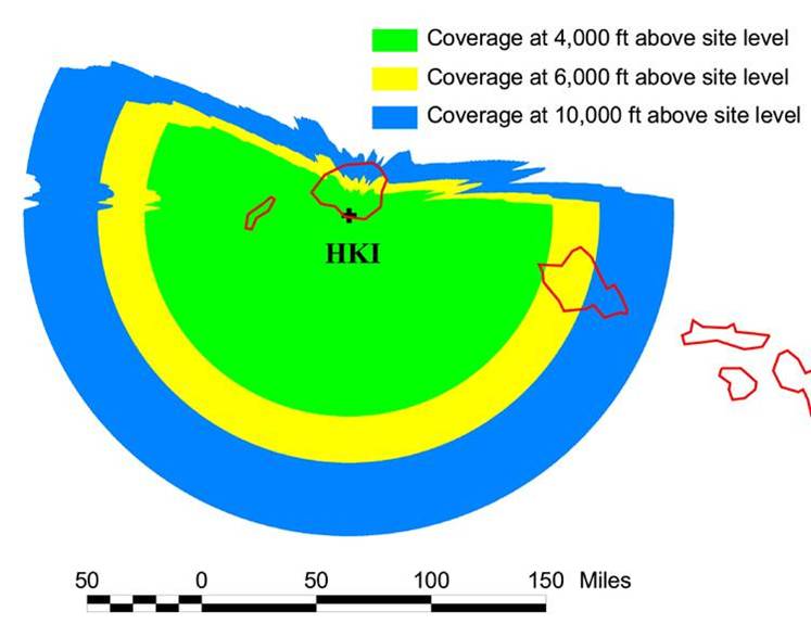
This location provides good coverage south of Kauai, and can be used for tropical cyclone surveillance. It also provides some coverage for western Oahu. However, it provides very poor coverage for northern Kauai.
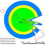 Molokai (PHMO): Located in the western hills of Molokai at an elevation of 1,400 feet.
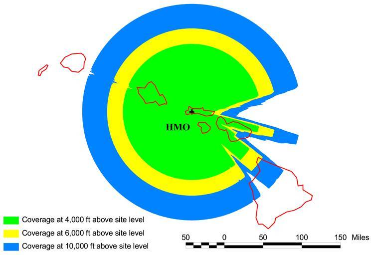
This location provides good overall coverage of Oahu, Molokai, Lanai, and most of Maui. However, it provides poor coverage of the east facing slopes of Haleakala.
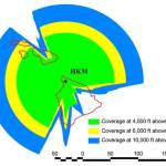 North Big Island (PHKM): Located on the northern side of the Kohala Mountains at an elevation of 3,900 feet.
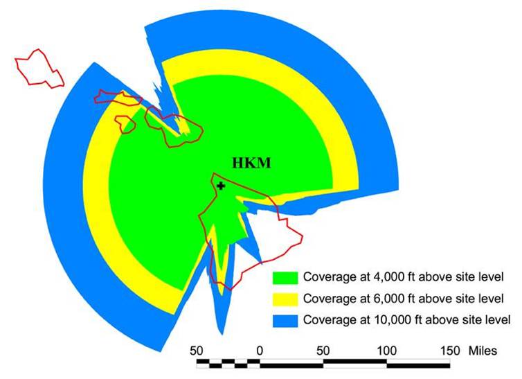
This location provides good coverage from south clockwise through northeast, including eastern Haleakala. However, it provides poor coverage from the Hamakua Coast through Hilo. Because of the elevation of the radar, it is also difficult for it to see the typically shallow trade wind showers beyond 50 miles.
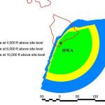 South Big Island (PHWA): Located between Naalehu and Pahala at an elevation of 1,460 feet.
This location provides good coverage to the southeast, and can be used for tropical cyclone surveillance. However, it provides poor coverage near Hilo and along the Kona coast.
Dual Polarization
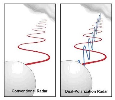
A comparison of conventional and dual-polarization radar beams.
The National Weather Service recently upgraded the hardware at all radars across the county. The original radars use a beam that oscillates in the horizontal direction. The upgraded radars will send beams that oscillate in both the horizontal and vertical directions. Comparing the two different beams can provide information about the size and shape of objects that the radar detects. This new information will help improve rainfall estimates and hail detection, and provide new information about precipitation type (e.g., rain, snow, ice).
The Kauai and North Big Island radars were upgraded in 2012, and the Molokai and South Big Island radars were upgraded in 2013.
You can view the latest weather radar images for Hawaii at:
http://www.prh.noaa.gov/hnl/pages/radar.php
John Bravender
Aviation Program Manager
National Weather Service Honolulu